I’ve noticed that PhotoLab can use the GPS co-ordinats (when available) to tell the world where a particular photo was taken.
My Leica M10 can do this, but only when I mount the Leica Visoflex device on my camera.
I’ve read that Nikon cameras can do this, by wirelessly connecting them to a smart phone.
I’m part way through doing this for my D780 and my iPhone 11 Pro.
Has anyone here done this, and is it worth doing?
If I do it, anyone viewing my images will be able to tell exactly where the image was taken. I’m not sure if this is a good idea, or not, for lots of reasons. I’m not yet sure if I should actually get this working on my cameras. Do I really want the world to know exactly where I stood while taking every photo?
(I would likely already be doing this with my M10, except that to mount the Visoflex on the camera, I first need to remove the thumb rest.)
I also wonder if new cameras have the GPS settings already built into the cameras?)
I bought an add-on GPS unit for my Pentax KP. It mounts in the hotshoe and uses its own battery. However, it takes an age to lock on to the satellites and requires calibration which is hit and miss.
The solution I have hit on is rather simpler. I have an app GPX Tracker on my iPhone and Apple Watch. When I am about to set off on my photo walk, I launch the app on my watch and start tracking. Hopefully I remember to stop it when I get back to my car — some tracks end up going all the way home.
Once I have ingested all the photos into Lightroom (yes, I still use that for managing my photos), I go to the Map module, load the track, and auto-locate the photos.
This does require keeping the camera’s internal clock accurate — ironically a task the dedicated GPS unit will do.
I don’t end up with keywords for the location in my photos, but when I upload to Flickr, it includes a small map with the location. I wish more photographers would do this! I follow a few local people on Flickr who post some bird shots of species I had no idea were around here and I’d love to know where!
I may have changed my mind - my Visoflex will do all this on my Leica, and I don’t remember it having a bad effect on battery life. I wish Nikon included GPS inside the D780. Oh well, I wanted that for the past ten years, maybe longer. As for GPS, it takes a while before the Visoflex “locks on”, but from then on, as long as I don’t shut the camera off, my memory is that it worked very well. Biggest drawback - my thumb-rest needs to be removed first, so the Visoflex can mount.
@zkarj, thanks! I just downloaded “GPS Tracks” to my iPhone. Fascinating, with all the things it can do. When I travel around India, this will be great. Maybe one of the premium versions will work with a camera?
Step #1 is to make sure the Visoflex is working.
Step #2 is to make sure the M10 is capturing that data.
Step #3 will involve PhotoMechanic, and
Step #4 will be PhotoLab.
Absolutely. And, even then, is it really the important to know exactly where it was taken? Far better to have a great image than to be distracted. You can always take a snap with your phone and then transfer the coordinates from there afterwards.
Oh, and don’t change back to the Leica just because it has GPS. Far better to concentrate on the best images from the best camera (the D780).
I now consider them both as “tools”, and I think most of the time, the D780 has far more to offer than the M10, but for “street photography” people can’t help but notice my Nikon, and they seem to ignore the Leica. The Nikon can “do” just about anything. The Leica is limited - wide angle or telephoto photography on the Leica is more difficult. With the Leica+Visoflex, it becomes a “mirrorless” camera in many ways, and I get GPS recordings automatically.
I haven’t used it even once since I returned from India, but my Fuji X100F is better than my other cameras for “street photography”, small, unobtrusive, black, and quiet. People react to it like it’s a “toy”. And it does have a flash, when needed. I don’t think it has GPS, although I think I can get that from my iPhone.
I’ve always been intrigued with GPS, and while I “want” it, I don’t “need” it. Speaking of GPS, the recommendation here for “GPS Tracks” for my iPhone was great - I love what I can do/see with that app.
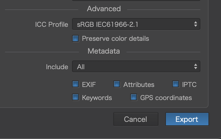
Before I forget, do I need to adjust any settings in PhotoLab to capture my GPS data, when available?
As @joanna pointed out above, just creating a track log in your phone is much better than the kludgey and battery hogs of the camera syncing apps.
I verify my camera time is consistent with my phone if travelling. Turn off wifi/bluetooth/cell on my phone to save battery and start a GPS track with one of several apps I use when in backcountry (mostly gaiagps). When I’m done I save and send the track to my PC. After culling, I keyword and geotag using the saved track as part of my image process. Been doing that for more than a decade starting with the old Garmin GPS tools. Very easy!
You can do this in LR, PM, and several third-party options. Yes, that would be nice if PL could do that.
While in many cases you don’t need hyper-accuracy, having the accuracy anyway is not a detriment. In cases where you do need it, then not having it is a detriment.
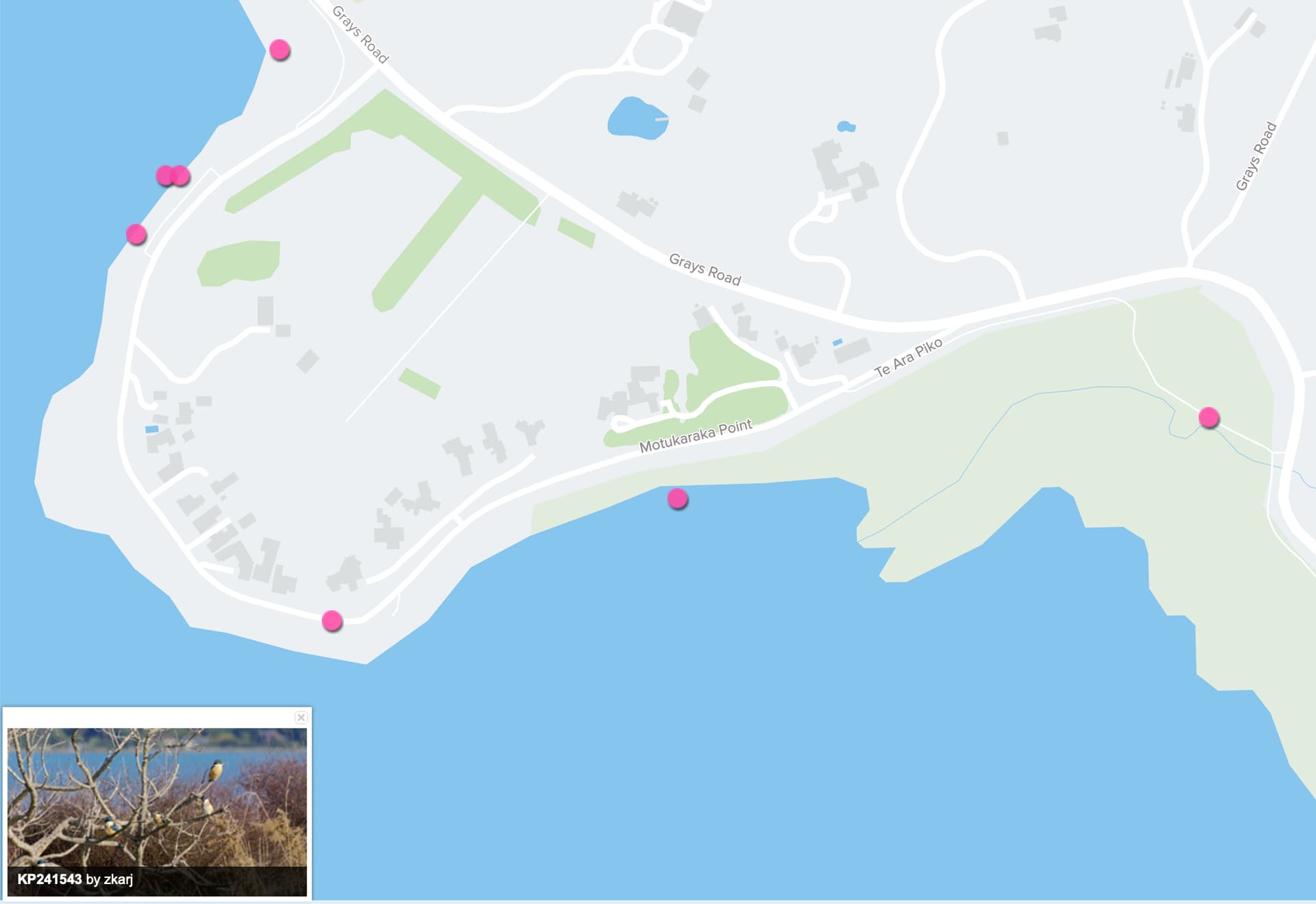
Take this picture for example. I know exactly where this tree is and every time I am going past it, I check it out to see if any Kingfishers are fishing there. Other people have expressed delight at such a gathering and they can also easily find the tree. Not so if I simply said “on the Te Ara Piko Trail, near Motukaraka Point.”
I am almost finished connecting my Nikon to my iPhone. Then I can save the GPS co-ordinates with my Nikon, just like with my Leica - but the iPhone method will be faster.
Joanna, there is no need to be distracted. Select this option once, and your Nikon will automatically capture the location information. You don’t need to “do” anything.
On the other hand, I’m still trying to “do” the setup procedure.
Mike. I tried this and got the most odd locations, like in the middle of the sea. It also drains both phone and camera batteries so, personally, I don’t see a use for it when I can simply take a shot with my phone and transfer the coordinates later if I were ever to need them.